
Day 3: Coal & Plate Motion Map Activity
Lesson Plan - Coal & Plate Motion Map Activity
Developed by 2008-2009 TESSE Graduate Fellows from Penn State University (http://sites.psu.edu/drlauraguertin/)
Objectives
Students will:
- Review the prime environmental conditions for the formation of coal.
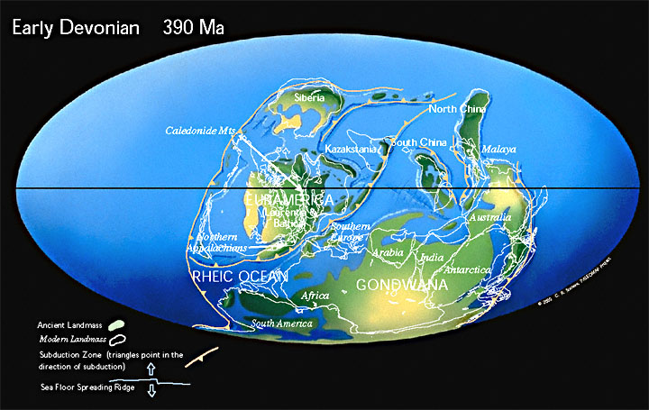
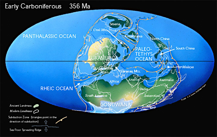
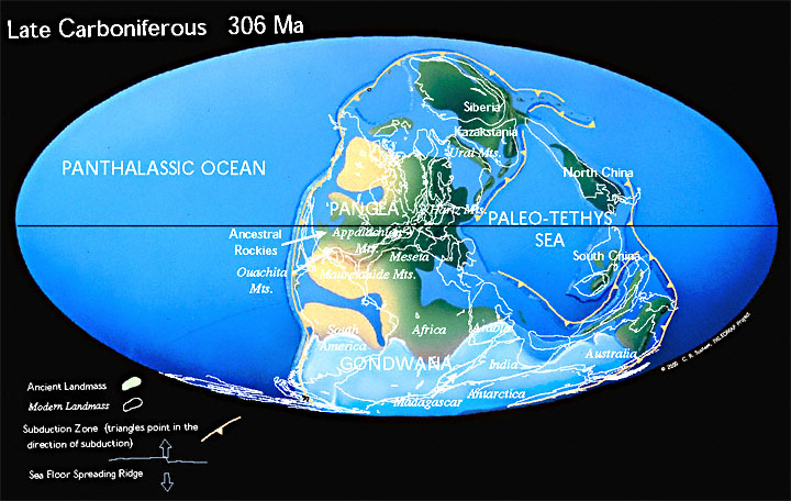
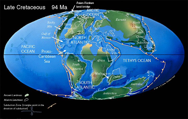
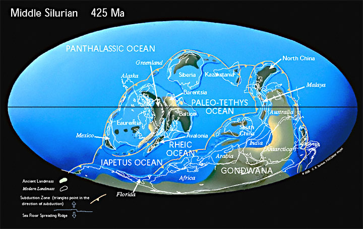
- Use paleomaps to examine plate motions from the Silurian to the Late Cretaceous and identify the main coal-forming period in Pennsylvania. (located in separate document)
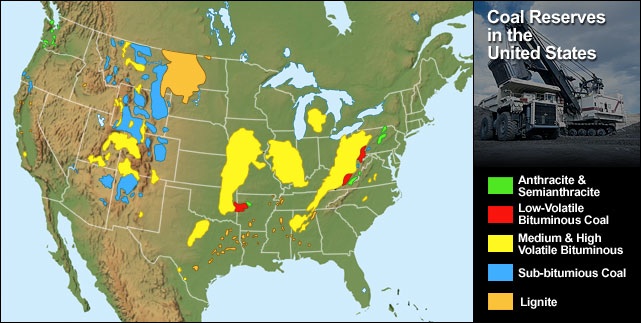
- Use paleomaps to explain the distribution of coal in other regions of the United States.
Materials
- U.S. Coal reserves map (two examples provided)
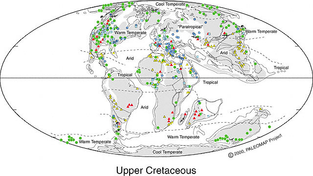
- Color copies of 5 Scotese paleomaps (Silurian, Devonian, Early Carboniferous, Late Carboniferous, and Late Cretaceous)
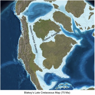
- Western Interior Seaway map
- Late Cretaceous Climate map
- Photos of U.S. swamps and illustrations of PA swamps 300 Ma
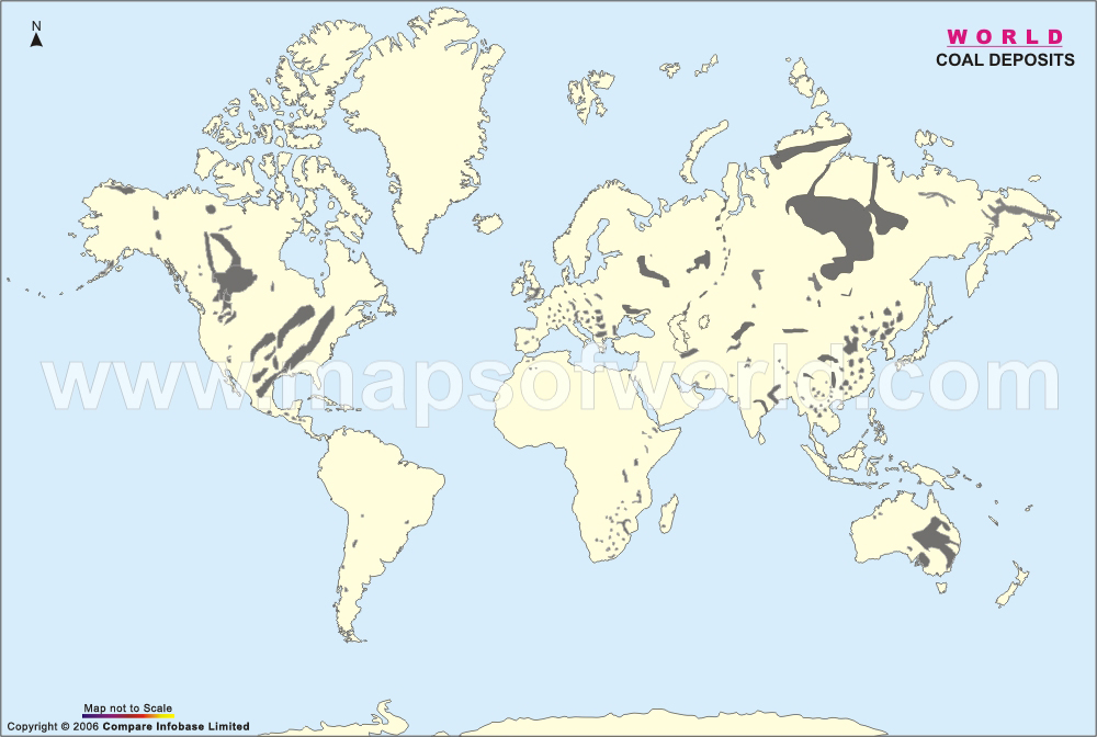
- World coal map for assessment exercise
List of Resources
| Attachment | Size |
|---|---|
| 10.79 MB | |
| 3.66 MB | |
| 118.01 KB | |
| 125.14 KB | |
| 124.71 KB | |
| 119.92 KB | |
| 126.91 KB | |
| 2.63 MB | |
| 83.15 KB | |
| 85.04 KB | |
| 6.46 MB | |
| 46.48 KB | |
| 278.88 KB |